Ah, Bishop… the biggest little town in the Eastern Sierras. It has a movie theater, a Von’s, and a DMV, which is saying more than most other towns within a fifty mile radius. Bishop is another major hub for hikers and climbers; it’s a major thoroughfare for the John Muir and Pacific Crest Trails. Great spot to restock and spend a little time in the mountains!
Where I camped:
 Buttermilk Road
GPS: 37.328331, -118.579231
Elevation: 6444′
Get Directions
I was warned this place can get crowded on weekends — the boulders and rock formations are apparently a magnet for climbers. I arrived on a Sunday night and only saw a few other cars! The sites are fairly spread out, and the views — like everywhere else I’ve been in the Eastern Sierra — are absolutely breathtaking. I suggest driving a several miles down the road (it gets pretty bumpy) until you start seeing large trees and bushy green shrubs on the left. There’s a roaring creek deep in a canyon in this area. I love falling asleep next to flowing water 🙂
Pine Creek Road
Bishop, California
GPS: 37.381359, -118.670738
Elevation: 6852′
Get Directions
I decided to try this site just to change things up one evening. It’s a nice place to camp, but I prefer the sites on Buttermilk Road. Most of the sites are shaded and situated along a roaring creek, but they’re located pretty close together and it was crowded on a Tuesday. If you’ve got a big rig, this location might be easier to access than Buttermilk Road.
 Where I worked:
Looney Bean Coffee
399 N Main St
Bishop, CA 93514
A digital nomad’s paradise! Looney Bean is spacious, full of outlets, and you could easily eat breakfast, lunch and dinner here. The waitstaff are exceptionally friendly, and they won’t bat an eye if you park yourself at a booth all day. The only downside is the music they have blaring from the speakers — bad, bad pop electronica. There’s a corner on the North side of the cafe where they’ve turned off the speaker — go there.
Where I hiked:
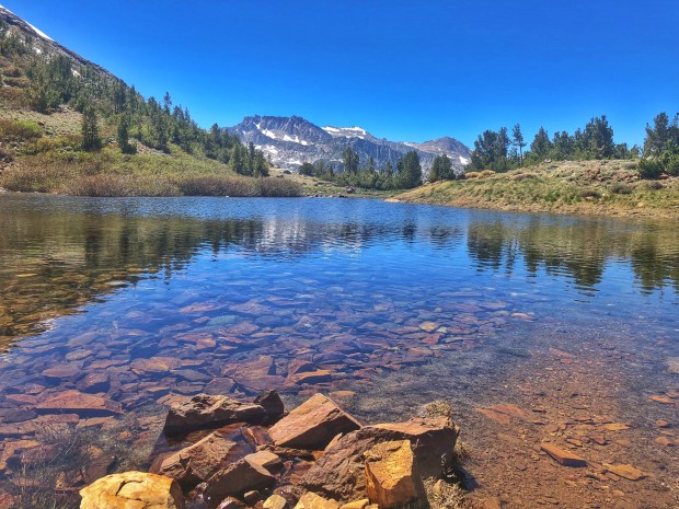
 Bishop Pass Trail
Distance: 9.5 miles round trip
Time: ~4 hours
Elevation gain: 2355 ft
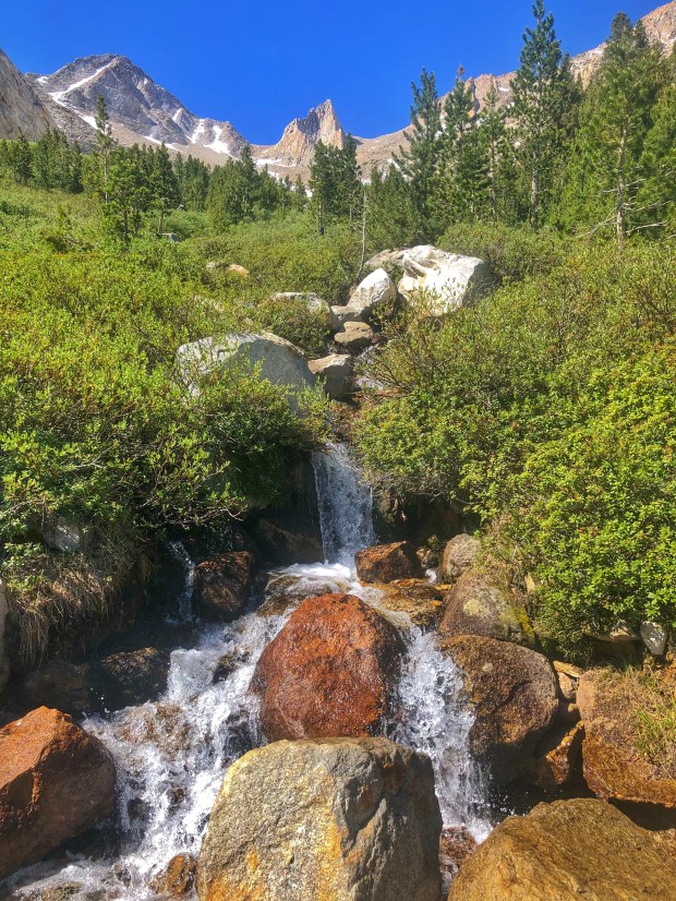
The Bishop Pass Trail is one of the most popular hikes in the Eastern Sierra, and for good reason. The views are spectacular, and you just hit beautiful lake, after beautiful lake, after beautiful lake. I didn’t quite make it to the pass, because I hit a section where about 75 deer had fallen to their death trying to cross a snow bridge. It was straight up ominous, and there was enough blood on the trail I was concerned about meeting scavengers along the way. Instead, I turned back and did the loop to Chocolate Lakes. It’s pretty out there, but the trail is somewhat hard to follow. Make sure you bring a good map!
 Pike Creek Trail to Honeymoon Lake
Distance: 11.2 miles round trip
Time: ~5 hours
Elevation gain: 3169 ft
One of the less crowded trailheads in the area, this was one of my favorites. The first section is steep and exposed — absolutely sweltering in early June — but once you get to 10,000ft it’s an easy jaunt to Honeymoon Lake. Because this hike starts at 7,000 feet, it’s much warmer than the other trails in the area. You’ll want to get an early start. But if you’re looking for peace, quiet, and more beautiful lakes, you’ve come to the right spot.
Piute Pass Trail
Distance: 16.7 miles round trip
Time: ~8 hours
Elevation gain: 3454 ft
Finally some shade! Yet another beautiful trek into the Sierras, with plenty of alpine lakes and wildflowers along the way. The trail is mostly shaded, and while the elevation climb is pretty gradual you’re starting at nearly 10,000 feet… so it helps if you’re already acclimatized. I turned back at the third lake so I could get to my car before sunset.


 Crane Prairie Reservoir
 South Sister
 Mill Creek
 Prospect Library
 Garfield Peak
 This place blew my mind. Maybe it was because we drove several hours through dry, desolate valleys and entered the park from the back. Maybe because as we entered the park, all I could think was: “Where are the big trees? I thought there would be big trees?” Maybe because the contrast between the world outside, and the world within this grove of giants was so stark.
 Rattlesnake Lake


 McDonalds
 Brokeoff Mountain
 What a happy surprise! My friend James flew out from London to join me in the van for a little while. I couldn’t be happier to share the next leg of the trip with another human.


 Where I camped:
  Tuttle Creek Ashram